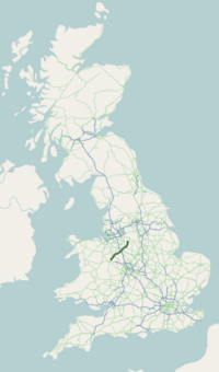
A53 road
| A53 | ||||
|---|---|---|---|---|
 | ||||
| Route information | ||||
| Length | 55.1 mi[1] (88.7 km) | |||
| History | 1920s (Constructed) | |||
| Major junctions | ||||
| North end | 53°15′33″N 1°54′24″W / 53.259216°N 1.906576°W | |||
| ||||
| South end | 52°44′48″N 2°43′03″W / 52.746671°N 2.717386°W | |||
| Location | ||||
| Country | United Kingdom | |||
| Counties | Derbyshire Staffordshire Shropshire | |||
| Primary destinations | Leek Stoke-on-Trent Newcastle-under-Lyme | |||
| Road network | ||||
| ||||
The A53 is a primary route in the English Midlands, that runs from Buxton in Derbyshire to Shrewsbury in Shropshire.
Route of Road
[edit]The A53 begins in the centre of Buxton off the A6 road, before meeting the A515 road at a roundabout. Out of the town, it has a junction with the A54 road (to Congleton) before continuing in a south-westerly direction. It crosses the border into the county of Staffordshire, and after leaving the Peak District travels through the town of Leek. It meets the A523 road (to Macclesfield) and the A520 road (to Stone). It crosses the Caldon Canal and travels through the Stoke-on-Trent conurbation, including Hanley and Newcastle-under-Lyme, where it meets a number of major routes such as the A50 road (to Derby), the A500 "D-Road," the Winchester-Salford A34 and the A525 road (to Whitchurch). It crosses the M6 motorway and goes through the village of Ashley. It crosses the border into Shropshire, and bypasses the town of Market Drayton, and passes the Müller factory. It meets the A41 road (to Wolverhampton) at a roundabout, then meets the A442 road (to Telford). It goes through the village of Shawbury, before it terminates at its junction with the A49 road, 3 miles (4.8 km) north-east of Shrewsbury town centre at Battlefield. The 1.9 km section to the south-west of Shawbury was bypassed in the 1950s - the original A53 road runs adjacent to Shawbury Heath and is now an unclassified country lane.
The road is single carriageway apart from a 1-mile (1.6 km) section of dual carriageway between the A500 and Stoke-on-Trent City Centre (Hanley).
Road safety
[edit]The A53 has been reported as a high risk road for several years. According to a report done by the Road Safety Foundation for the European Road Assessment Programme (EuroRAP), the A53 is one of the most dangerous roads in the UK.[2]
In June 2008, a 12-mile (19 km) stretch of the A53 between Leek and Buxton was named as the most dangerous road in the West Midlands.[3][4] This single carriageway stretch had fourteen fatal and serious injury collisions between 2003 and 2005, and was rated as red—the second highest risk band—in the EuroRAP report publish by the Road Safety Foundation. The challenging character of this section of road makes it attractive to motorcyclists.
| County | Location | mi[1] | km | Destinations | Notes |
|---|---|---|---|---|---|
| Derbyshire | Buxton | 0.0 | 0.0 | Northern terminus | |
| 0.4 | 0.64 | Northern terminus of A515 | |||
| 0.5 | 0.80 | Southern terminus of A5004 | |||
| 2.0 | 3.2 | Eastern terminus of A54 | |||
| Staffordshire | Leek | 12.3 | 19.8 | Northern terminus of A523 concurrency | |
| 12.7 | 20.4 | Southern terminus of A523 concurrency | |||
| 13.0 | 20.9 | Information signed northbound only; northern terminus of A520 | |||
| Baddeley Green | 19.1 | 30.7 | Baddeley Green Lane (A5009 south) – Milton, Stoke-on-Trent, Stoke | Information signed northbound only; northern terminus of A5009 | |
| Smallthorne– Sneyd Green boundary | 21.0– 21.1 | 33.8– 34.0 | |||
| Cobridge | 22.0 | 35.4 | Kidsgrove, Fenton, Longton, Burslem and Tunstall signed southbound only, Warrington northbound only | ||
| Etruria | 22.5– 22.8 | 36.2– 36.7 | Junction; western terminus of A5010 | ||
| Newcastle-under-Lyme | 23.3 | 37.5 | To A34, Nantwich and Congleton signed northbound only; junction on A500 | ||
| 24.2 | 38.9 | Ashbourne signed southbound only; northern termminus of A52 concurrency | |||
| 24.4 | 39.3 | To A34 and Congleton signed southbound only, To A500, Tunstall and Biddulph northbound only; southern terminus of A52 concurrency; southern terminus of A527 | |||
| 24.7 | 39.8 | A519 and Eccleshall signed southbound only; northern terminus of A34 concurrency; northern terminus of A519 | |||
| 24.8 | 39.9 | Southern terminus of A34 concurrency | |||
| Whitmore | 27.8 | 44.7 | Western terminus of A5182 | ||
| Maer | 31.6 | 50.9 | Northern terminus of A51 concurrency | ||
| 31.8 | 51.2 | Southern terminus of A51 concurrency | |||
| Shropshire | Market Drayton– Adderley boundary | 38.9 | 62.6 | ||
| Ternhill | 41.9 | 67.4 | |||
| Hodnet | 45.2 | 72.7 | Northern terminus of A442 | ||
| Shrewsbury | 55.1 | 88.7 | Southern terminus; northern terminus of A5112; eastern terminus of A5124 | ||
1.000 mi = 1.609 km; 1.000 km = 0.621 mi
| |||||
References
[edit]- ^ a b "Harley's Remedies - Holistic Therapist, Buxton SK17 7DJ, United Kingdom to Battlefield Roundabout, Shrewsbury SY4 3EQ, UK". Google Maps. Retrieved 26 March 2025.
- ^ "'Most dangerous' roads revealed". bbc.com. 25 June 2007.
- ^ Highest risk road sections in each UK Government Office Region (2004–2006) Archived 10 February 2012 at the Wayback Machine
- ^ A53 IS WEST MIDLAND'S MOST DANGEROUS ROAD[permanent dead link]


